USGS Home - www.usgs.gov NASA - National Aeronautics and Space Administration NOAA - National Oceanographic and Atmospheric Administration National Park Service
Coastal and Marine Geology Program

Mapping Coastal Change Hazards

Coastal Change Photographs - Topsail Island, NC

Introduction Hazard Scale First Line of Defense Northeaster Hurricane El Niño Photos
Topsail Island, NC - Hurricane Fran, 1996:     Pair 1  |  Pair 2

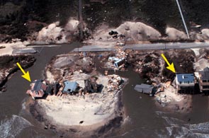
Below are oblique aerial photographs taken on Topsail Island, North Carolina before and after Hurricane Fran in 1996. The yellow arrows point out the same buildings in both photos. Note the destroyed buildings, the overwash, and the damaged road in the post-storm photo on the right. Click on either photo to view a larger version.

Before: July, 1996
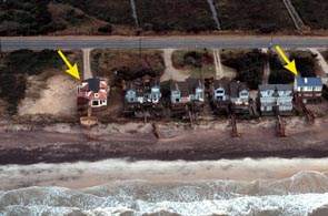
oblique aerial photograph of Lee's Ravine taken in July 1996
After: September, 1996
oblique aerial photograph of Lee's Ravine taken in September 1996

Introduction Hazard Scale First Line of Defense Northeaster Hurricane El Niño Photos
Topsail Island, NC - Hurricane Fran, 1996:     Pair 1  |  Pair 2


Coastal and Marine Geology Program > Center for Coastal Geology > Hurricane and Extreme Storm Impact Studies > Mapping Coastal Change Hazards > Coastal Change Photographs > Topsail Island, NC

FirstGov.gov U. S. Department of the Interior | U.S. Geological Survey
Coastal and Marine Geology Program

email Feedback | USGS privacy policy & disclaimers

This page is http://coastal.er.usgs.gov/hurricanes/mappingchange/photos.html
Updated May 07, 2001 @ 04:18 PM (THF)