
Volcano Monitoring Network
Trilateration and distance-measuring networks have been established on
potentially active volcanoes in the Pacific Coast States beginning in 1980.
These networks, once the baseline information has been collected, can detect
surface deformation that may reflect magma movement up the conduit. The rates
of deformation increase as magma approaches the surface, and these measurements
can therefore help determine where and when an eruption may occur.
-- Chadwick, Iwatsubo, Swanson, and Ewert, 1985; and
Iwatsubo and Swanson, 1992
|
CVO Deformation Project -
Volcano Networks
|
| |
EDM |
GPS |
Leveling |
Tilt Meter |
Dry Tilt |
MAG |
| Mount Hood |
1983
1984 |
|
|
|
1983
1984 |
|
|
Earthquake Monitoring
Earthquakes commonly provide the earliest warning of volcanic unrest, and
earthquake swarms immediately precede most volcanic eruptions.
Information on Pacific Northwest
earthquake activity and hazards
is provided by
the
Pacific Northwest Seismograph Network (PNSN)
which operates seismograph stations and locates earthquakes
in Washington and Oregon. The PNSN
is operated jointly by the University of Washington, the University of Oregon,
and Oregon State University, and is funded by the U.S. Geological Survey, the
Department of Energy, and the State of Washington. The PNSN
is based at the Geophysics Program of the University of Washington in Seattle,
and is a member of the Council of the National Seismic Systems (CNSS), a group
of regional network operators who cooperate to locate and catalog earthquakes
throughout the United States.
-- Wright and Pierson, 1992; and
the University of Washington's Geophysics Program
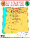 [Map,30K,InlineGIF]
University of Washington's Pacific Northwest Seismograph Network
-- Oregon and Southern Washington
-- Modified from:
University of Washington Geophysics Program, 1999
Link to:
Current Seismicity -- Link courtesy
University of Washington Geophysics Program
|
Baseline Gas Sampling
In 1992,
Volcano Emissions and Global Change Project
began a program to
systematically collect and analyze gases from potentially active volcanoes in
the Pacific Northwest and Alaska. For each volcano studied, the USGS is (1)
conducting reconnaissance studies of available fumaroles, and (2) collecting
samples from selected fumaroles to determine the chemical and isotopic
compositions of the gases. These data will help constrain the current status
of degassing at these volcanoes and the compositions and origins of their
volcanic gases. Frequent resampling of selected fumaroles may detect changes
in the subvolcanic system, including the injection of new magma. Volcanoes
studied to date include Mount St. Augustine,
Mount Baker,
Mount Hood,
and volcanoes in Katmai National Park (Mount Griggs and
Trident).
-- Volcano Emissions and Global Change Project Web Pages, 1996
|
|
