The Volcanoes of Lewis and ClarkApril 9, 1806 |
|
Home
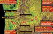
-- The Volcanoes of Lewis and Clark Map of the Journey -- Volcanoes, Basalt Plateaus, Major Rivers, etc. CALENDAR of the Journey -- October 1805 to June 1806 Along the Journey -- Pacific Northwest Maps - Columbia River, Volcanoes, Flood Basalts, Missoula Floods, Geology, etc. The Corps of Discovery -- The Journey of Lewis and Clark About the Reference Materials -- The Journals, Biddle/Allen, DeVoto, Gass, Moulton, Topo Maps, and others USGS Lewis and Clark Links -- Links to USGS Websites highlighting the Lewis and Clark Journey Resources Publications Referenced and Websites Visited |
PREVIOUS
April 6-8 Columbia River Gorge, Cottonwood Beach Camp to Shepperd's Dell |
April 9
Columbia River Gorge, Shepperd's Dell to Bonneville Shepperd's Dell and Shepperd's Dell State Park, Bishop's Cap and Cape Horn, Multnomah Falls, Columbia Gorge Waterfalls and Lava Flows, Beacon Rock, Hamilton Island, Bradford Island, Bonneville Vicinity, Bonneville Dam |
CONTINUE
April 10-12 Columbia River Gorge, Cascade Locks Vicinity |
| On October 7, 1805, Lewis and Clark and the "Corps of Discovery" began their journey down the Clearwater River and into the volcanics of the Pacific Northwest. The Corps travelled from the Clearwater to the Snake and down the "Great Columbia", finally reaching the Pacific Ocean on November 15, 1805. Along the journey they encountered the lava flows of the Columbia Plateau, river channels carved by the great "Missoula Floods", and the awesome beauty of five Cascade Range volcanoes. |

| The Volcanoes of Lewis and Clark |
| Heading Home - April 1806 |
|
Columbia River Gorge
Shepperd's Dell to Bonneville |
| Lewis and Clarks camp from April 6 through April 8, 1806, was in the area of today's Shepperd's Dell State Park, Oregon. |
|
|


 Shepperd's Dell and Bishop's Cap:
Shepperd's Dell State Park: In 1915, a local dairy farmer named George Sheppherd gave all that he had (this tract of land) to the City of Portland as a memorial to his wife. Today, thousands of visitors along the Historic Columbia River Highway visit this beautiful spot, with its roaring waterfall cascading down steep cliffs into Youngs Creek and out to the Columbia River far below. The upper fall is around 42' tall. The lower tier is around 50' tall. One of the most beautiful and historic highway bridges crosses the canyon here, but you can't see or appreciated it unless you leave your car and take the short trail to the falls. Shepperd's Dell State Park is located along Historic Columbia River Highway, 14 miles east of Troutdale, Oregon. -- Oregon State Parks and Recreation Website, 2002 |
| The wind having moderated, we reloaded the canoes, and set out by seven o'clock. We stopped to take up two hunters who had left us yesterday, but were unsuccessful in the chase, and then proceeded to the Wahclellah village, situated on the north side of the river, about a mile below Beacon rock. [Beacon Rock] During the whole of the route from our camp, we passed along under high, steep, and rocky sides of the mountains, which now close on each side of the river, forming stupendous precipices, covered with the fir and white cedar. |
| Among the many scenes - Bishop's Cap on the Oregon side and Cape Horn on the Washington side. The banks of the Columbia River are heavily timbered slopes of basalt flows and landslide blocks. |
|
|


 Cape Horn:
Cape Horn: On the Washington side of the Columbia River, across from Phoca Rock, is "Cape Horn". A pullout along Washington Highway 14 is available, with good views of the Columbia River, Beacon Rock, Cape Horn, Phoca Rock, and the Oregon side of the Columbia. Lewis and Clark passed by Cape Horn on November 2, 1805. |
| Down these heights frequently descend the most beautiful cascades, one of which a large creek, throws itself over a perpendicular rock three hundred feet above the water, while other smaller streams precipitate themselves from a still greater elevation, and evaporating in a mist, again collect and form a second cascade before they reach the bottom of the rocks [Multnomah Falls ???]. We stopped to breakfast at this village. ...... |
|
|

 Multnomah Falls:
Multnomah Falls: Multnomah Falls, plummeting 620 feet from its origins on Larch Mountain, is the second highest year-round waterfall in the United States. Nearly two million visitors a year come to see this ancient waterfall making it Oregon's number one public destination. Fed by underground springs from Larch Mountain, the flow over the falls varies usually being highest during winter and spring. Multnomah Falls offers one of the best places in the Columbia River Gorge National Scenic Area to study geology exposed by floods. Five flows of Yakima basalt are visible in the fall's cliff face. The two falls are produced because of a more easily eroded zone at the base of the upper falls. -- U.S. Forest Service Website, 2002, and Beeson and Tolan, 1987 Lava Flows and the Gorge Waterfalls: The presence of prominent vertical cooling joints in most of the lava flows, combined with the weak interflow zones result in steep cliffs and abundant waterfalls. Observations of waterfalls occurring over Columbia River basalt flows have shown that falls often occur where flows are flat lying or dipping upstream. This condition allows blocks produced by vertical cooling joints to be stable until support is withdrawn by erosion of the weaker interflow material at the base of the flows. The rate of erosion of interflow material probably largely controls the rate of retreat of the falls. The amphitheater-shaped valley common to many of the falls within the gorge is due to freeze-thaw action of water from splash mist that penetrates the joints. Most waterfalls are limited to the Oregon side of the Columbia River Gorge because landslides modify the steepness on the Washington side. The entire region's bedrock material is tilted slightly southward. When it is water saturated, the upper basaltic layers on the north side of the river slide into the Gorge. Thus, waterfalls on the Washington side are fewer and smaller. -- Beeson and Tolan, 1987 |
| As these people had been very kind to us as we descended the river, we endeavoured to repay them by every attention in our power. After purchasing, with much difficulty, a few dogs and some wappatoo from the Wahclellahs, |
| "... a large creek puts in close above the village which we did not discover last fall [Woodward Creek ???] . when we passd down we dined and proceed. on ..." [Ordway, April 9, 1806] |
| we left them at two o'clock, and passing under the Beacon rock [Beacon Rock], reached in two hours the Clahcellah village. This Beacon rock, which we now observed more accurately than as we descended, stands on the north side of the river, insulated from the hills. The northern side has a partial growth of fir or pine. To the south it rises in an unbroken precipice to the height of seven hundred feet, where it terminates in a sharp point, and may be seen at the distance of twenty miles below. This rock may be considered as the commencement of tide-water, though the influence of the tide is perceptible here in autumn only, at which time the water is low. What the precise difference at those seasons is, we cannot determine; but on examining a rock which we lately passed, and comparing its appearance now with that which we observed last November, we judge the flood of this spring to be twelve feet above the height of the river at that time. From Beacon rock as low as the marshy islands [area of Lewis and Clark National Wildlife Refuge, near the mouth of the Columbia], the general width of the river is from one to two miles, though in many places it is still greater. ...... |
|
|
|
| "... at 2 oClock P. M. we set out and passed under the Beacon rock on the North Side of two small Islds. situated nearest the N. side ..." [Clark, April 9, 1806] |
| As our large canoes could not ascend the rapids on the northside [Lewis and Clark have once again reached the "Lower Falls of the Columbia", the area of today's Bonneville Dam and Cascade Locks], we passed to the opposite shore, and entered the narrow channel which separates it from Brant island [Bradford Island]. |
| "... at 4 P. M. we arived at the first rapid at the head of Strawberry island [Hamilton Island], at which place on the N W. Side of the Columbia here we found the nativs from the last village rebuilding their habitations of the bark of their old village ... as we could not pass with the large canoes up the N.W. Side for the rocks, the wind high and a rainey disagreeable evining. our smallest canoe being too low to cross through the high waves, we sent her up on the N W. Side with Drewyer and the two Fields and after purchaseing 2 dogs crossed and into the sluce of a large high Island [Bradford Island], seperated from the S.E. Side by a narrow channel. in this chanel we found a good harbor and encamped on the lower side. evening wet & disagreeable ..." [Clark, April 9, 1806] |
| " ... in the evening we came to a large rapid at the lower end of Strawberry Island [Bradford Island, Gass used the name "Strawberry Island" in error - see notes.] ; where there are a number of the natives about settling on the north side. Here we crossed over, after buying two dogs from them, and encamped behind the island. Some rain continued falling. ..." [Gass, April 9, 1806] |
| "... passd Strabury Island [Hamilton Island] where the Swift water begins. we halted at a village at the foot of the 1st rapid, on N. Side which was lately erected. we purchased 2 fat dogs and crossed over to the South Shore and Camped behind [blank] Island [Bradford Island] commenced raining hard & high winds from N.W. the River much higher at this time than it was last fall when we passd. down. Some Spots of Snow is now on the tops of these Mountains Near the River. ..." [Ordway, April 9, 1806] |
|
|


 Hamilton Island:
Hamilton Island: Lewis and Clark's Strawberry Island is now Hamilton Island. Assertations that Bradford Island is the Strawberry Island of Lewis and Clark are not substantiated by the maps of the explorers. It is apparent from both text and maps that Lewis and Clark used the name Brant Island for what is now known as Bradford Island. Their Strawberry Island is now Hamilton Island, close to the north bank. However, on the return journey, Patrick Gass used the name Strawberry Island in error for what was then Brant Island, now Bradford. This was on the evening of April 9, 1806. -- McArthur, 1982, Oregon Geographic Name |
|
|
 Bradford Island:
Bradford Island: Lewis and Clark's Strawberry Island is now Hamilton Island. Assertations that Bradford Island is the Strawberry Island of Lewis and Clark are not substantiated by the maps of the explorers. It is apparent from both text and maps that Lewis and Clark used the name Brant Island for what is now known as Bradford Island. Their Strawberry Island is now Hamilton Island, close to the north bank. However, on the return journey, Patrick Gass used the name Strawberry Island in error for what was then Brant Island, now Bradford. This was on the evening of April 9, 1806. -- McArthur, 1982, Oregon Geographic Name |
| The weather was very cold and rainy, and the wind so high, that we were afraid to attempt the rapids this evening, and therefore, finding a safe harbour, we encamped for the night [on the Oregon side of the Columbia at the location of today's Bonneville Dam]. ...... |
|
|


 Bonneville Vicinity:
Bonneville Vicinity: Lewis and Clark's map of the area they referred to as the "Lower Falls of the Columbia". Bradford Island was called Brant Island and Hamilton Island was Strawberry Island. In 1896 the Cascade Locks were built, and in 1938 Bonneville Dam was completed. |
|
|
|
The Camp - April 9, 1806:
Lewis and Clark camped on the Oregon side of the Columbia River, at a location now near the Bonneville Dam. |
Return to:
[Volcanoes and History Menu] ...
[Living With Volcanoes Menu] ...
