The Volcanoes of Lewis and ClarkApril 13, 1806 |
|
Home
-- The Volcanoes of Lewis and Clark Map of the Journey -- Volcanoes, Basalt Plateaus, Major Rivers, etc. CALENDAR of the Journey -- October 1805 to June 1806 Along the Journey -- Pacific Northwest Maps - Columbia River, Volcanoes, Flood Basalts, Missoula Floods, Geology, etc. The Corps of Discovery -- The Journey of Lewis and Clark About the Reference Materials -- The Journals, Biddle/Allen, DeVoto, Gass, Moulton, Topo Maps, and others USGS Lewis and Clark Links -- Links to USGS Websites highlighting the Lewis and Clark Journey Resources Publications Referenced and Websites Visited |
PREVIOUS
April 10-12 Columbia River Gorge, Cascade Locks Vicinity |
April 13
Columbia River Gorge, Cascade Locks to Dog Mountain Cascade Locks, Wind River, Wind Mountain, Dog Mountain |
CONTINUE
April 14 Columbia River Gorge, Dog Mountain to Major Creek |
| On October 7, 1805, Lewis and Clark and the "Corps of Discovery" began their journey down the Clearwater River and into the volcanics of the Pacific Northwest. The Corps travelled from the Clearwater to the Snake and down the "Great Columbia", finally reaching the Pacific Ocean on November 15, 1805. Along the journey they encountered the lava flows of the Columbia Plateau, river channels carved by the great "Missoula Floods", and the awesome beauty of five Cascade Range volcanoes. |
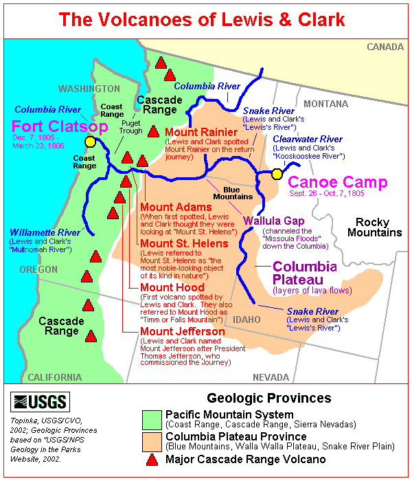
| The Volcanoes of Lewis and Clark |
| Heading Home - April 1806 |
|
Columbia River Gorge
Cascade Locks to Wind River |
| Lewis and Clark's camp of April 12, 1806, was on the Washington side of the Columbia River, above the Cascade Locks, just north of today's Bridge of the Gods. In the end of October in 1805 the Lewis & Clark expedition reached the Schutes of the Columbia, in the area today known as Cascade Locks. The expedition was forced to portage around these falls on November 1st, and again on their return trip in the spring of the following year. The falls were later bypassed by the development of a set of locks in 1896, and subsequently drowned with the competion of the Bonneville Dam in 1938. |
|
|


 Cascade Locks:
Cascade Locks: In 1896 the Federal Government built a series of locks around the treacherous Cascades rapids. In November, 1878, construction began. However, it was not until November 1896, that the locks were dedicated and opened for use. Delays in construction included reduction of appropriations by Congress, winter storms, high water, deep snows, and delays in receiving materials. During this time, the community grew from a small settlement of Native Americans and three white families to a booming construction town with all the flavor of the wild west. By 1893, there were about 1,000 inhabitants, many living in tents, shacks, and other temporary buildings. There were many saloons established, and it was during this time that the community was frequently called "Whiskey Flat". After the construction of the locks, the town became Cascade Locks. The Cascade Locks Marine Park has an Interpretive sign, trail, and museum. -- Oregon State Archives Website, 2002, Lewis & Clark Bicentennial of Oregon Website, 2002, and City of Cascade Locks Website, 2002 |
| The loss of our periogue yesterday obliges us to distribute our leading between the two canoes, and the two remaining periogues. This being done, we proceeded along the north side of the river [Washington State], but soon finding that the increased loading rendered our vessels difficult to manage, if not dangerous in case of high wind, the two periogues only continued on their route, while captain Lewis with the canoes crossed over to the Yehhuh village, with a view of purchasing one or two more canoes. ...... He [Captain Lewis] proceeded along the south side of the river [Oregon], and joined us in the evening. We had gone along the north shore as high as Cruzatte's river [Wind River], to which place we had sent some hunters the day before yesterday, and where we were detained by the high winds. |
|
|
 Wind River:
Wind River: Wind River basin, located in southwestern Washington, originates in McClellan Meadows in the western Cascades and enters Bonneville Reservoir at River Mile (RM) 154.5 near Carson, Washington. Wind River, a fifth order stream, drains approximately 225 square miles of Skamania County over a distance of approximately 31 miles. Principle tributaries to Wind River include Little Wind River, Bear, Panther, Trout, Trapper, Dry, Nineteenmile, Falls and Paradise creeks. The basin is oriented northwest to southeast with elevations ranging from 80 - 3,900 feet. Topography varies within the watershed; it is steep in the northwest and lower southeast, gentle in the northeast - McClellan Meadows area, and it is benchy in Trout Creek Flats and middle portions of the Wind River Valley. The mainstem of the Wind River drops 3,820 feet in 30.5 miles for an average gradient of 2.3 percent. Shipherd Falls, located at RM 2.0, is a series of four falls ranging from 8 to 12 feet that were a barrier to all anadromous salmonids except steelhead until the construction of a fish ladder in 1956. Originally Lewis and Clark called this river the "New Timber River". The name was later changed to "Crusats River," after a member of the corps, Pierre Cruzatte. At Fort Clatsop, Clark realized that Cruzatte was the only member of the corps who had not been honored with a place name on the westbound journey. He changed the name on the route map and course distance log, correcting the oversight. The present descriptive name was given by Isaac Stevens in 1853. -- Columbia Basin Fish and Wildlife Authority Website, 2002, and Washington State Historical Society Website, 2002 Geology of the Wind River Watershed: The Wind River Watershed has been shaped through 25 million years of volcanic activity and glacial action. Most of the watershed was formed 12 and 25 million years ago with some younger flows out of Indian Heaven and Trout Creek Hill being dated between 350,000 to three million. The flows out of Trout Creek Hill are the youngest at about 300,000. The majority of the watershed is in the older volcaniclastic material. These areas are more susceptible to erosion and mass failure due to the weathering of the material to silts and clays. Glacial activity has had an effect on the landscape especially in the upper regions of the watershed by Indian Heaven, where volcanic flows have scoured and smoothed the land. Outwash and alluvial material from this time period have been eroding down through the Wind River Valley. Since the construction of Bonneville Dam, this material has been accumulating at the mouth of the Wind River. Other material that has been moving into the streams in the lower parts of the valley are flood deposits left from the Bretz Floods from ancient Lake Missoula. Sediment input has also resulted from large landslides in the watershed. Most subbasin soils originate from weathered bedrock. Alluvial soil is found along the river and some soils north of Paradise Creek were buried under a thin layer of ash and pumice from Mt. St. Helens. Major woodland soils are deep and well drained but become shallow as elevation increases. -- Columbia Basin Fish and Wildlife Authority Website, 2002  River Drainages of Mount Adams:
|
| Lewis and Clark are passing through the heart of the Columbia River Gorge. Some of the volcanic features they are passing in this area are Shellrock Mountain (Oregon), and Wind Mountain (Washington). |
|
|
 Shellrock Mountain:
|
|
|
 Wind Mountain:
Wind Mountain: Gentle folding accompanied by eruptions from several andesitic and basaltic volcanoes took place during the Pliocene. This was followed by erosion that stripped away the lava flows, leaving only scattered plugs of diorite and diabase. Beacon Rock and Wind Mountain are remnants of these plugs. -- U.S. Forest Service Website, 2002, Gifford Pinchot National Forest |
| The hunters however did not join us, and we therefore, as soon as the wind had abated, proceeded on for six miles, where we halted for captain Lewis, and in the meantime went out to hunt. [vicinity of Dog Mountain] ...... |
|
|
Dog Mountain:
Dog Mountain Landslide: Local landslides, some taking place as recently as 200 years ago, have occurred in several areas along the Columbia River. The large Bonneville landslide, between the cities of North Bonneville and Stevenson, exposed the Red Bluffs. Steever soils formed in material from this landslide (stony clay loam, highly productive forest soils). The landslide, which consists chiefly of the Eagle Creek Formation and Yakima Basalt, blocked the Columbia River for a short period. Another landslide between Wind Mountain and Dog Mountain consists chiefly of material from the Ohanapecosh Formation. This landslide is still active. It moves 40 to 50 feet a year at the upper end of the slide and 5 to 10 feet a year at the toe. -- U.S. Forest Service Website, 2002, Gifford Pinchot National Forest Geology of this area: Skamania County Area is in the Cascade Range uplift, a region characterized by deeply dissected mountains. Between Cape Horn and Underwood Mountain, the Columbia River has cut through the Cascade Range to form the Columbia River Gorge, a deep canyon lined by precipitous slopes that have outcrops of basalt and andesite. The Cascade Range in Skamania County is of particular interest because it contains the most complete stratigraphic section of Tertiary and Quaternary volcanic rocks in the state. In the Wind River area are extensive deposits of Cenozoic lava and volcanic debris. These rocks are divided into four units: Ohanapecosh Formation, Eagle Creek Formation, Yakima Basalt, and Quaternary basalt flows (13). The oldest unit, Eocene to early Oligocene in age, is the Ohanapecosh Formation of the Mount Rainier region. It is nearly 19,000 feet thick. The lower twothirds of this unit is composed mostly of andesitic pyroclastic debris in tuff breccia. The upper 6,000 feet of the formation, which was deposited during the Oligocene Epoch, is composed of about equal amounts of conglomerate and sandstone, tuff, and pyroclastic breccia. Following folding and uplift, the top of the Ohanapecosh Formation was deeply weathered. Andesitic gravel and sand of the Eagle Creek Formation were then deposited over the Ohanapecosh Formation during the early Miocene. The Eagle Creek Formation was then eroded, and the resulting topography was inundated by Yakima Basalt from the east during the late Miocene. Deposits of the Eagle Creek Formation in the survey area were about 1,300 feet thick. Yakima Basalt flows in the area are as much as 2,000 feet thick. Aschoff, Skoly, and Zygore soils formed in residuum and colluvium derived from these formations. Gentle folding accompanied by eruptions from several andesitic and basaltic volcanoes took place during the Pliocene. This was followed by erosion that stripped away the lava flows, leaving only scattered plugs of diorite and diabase. Beacon Rock and Wind Mountain are remnants of these plugs. Some granodiorite is exposed in the southwestern part of the survey area. Dougan soils formed in residuum and colluvium derived from these intrusive formations. Quaternary volcanism has been limited to the extrusion of basalt flows from at least ten different vents. The lavas can be grouped into olivine, platy olivine, and low-alumina basalt. These include flows from the Red Mountain and Trout Creek Hill volcanoes and flows of the Big Lava Bed north of Willard (7). Some of the accompanying volcanic ash and pumice accumulated on terraces in the upper Wind River area. The Stabler soils formed in this material, whereas the Chemawa soils formed in alluvium derived from volcanic ash and basalt. -- U.S. Forest Service Website, 2002, Gifford Pinchot National Forest |
| "... we passed Crusatte's river, when the wind rose so high we could not go on, so we halted and waited for Capt. Lewis. Two hunters went out about 3 hours, but killed nothing. By this time the wind fell and we went on 3 miles to a better harbour, where we halted on the north side of the river. Capt. Clarke and 3 men went out to hunt; and Capt. Lewis having come up and rossed over to us, we fixed our camp for the night ..." [Gass, April 13, 1806] |
| "... we proceeded on little above cruzattes River the wind rose So high that obledged us to halt at this bottom where we expected to find our Hunters ... the day proved fair the wind cold and Snow laying low on the Mountains near the River. ... we then proceed. on about 5 miles and halted again at a bottom on the N. Side 3 men went out a hunting. Sergt. Pryor & 2 men Sent back to cruzattes River to look again for the hunters one of the hunters killed two Deer. Capt. Lewis & party overtook us had purchased two Small canoes the price of which was 2 Small peaces of blue cloath and two Elk hides, & bought three dogs also. we dryed the 2 Small canoes by fire and pitched them &c.; ..." [Ordway, April 13, 1806] |
|
|
|
The Camp - April 13, 1806:
Lewis and Clark camped on the Washington side of the Columbia, near Dog Mountain, between Collins Creek and Dog Creek. |
Return to:
[Volcanoes and History Menu] ...
[Living With Volcanoes Menu] ...
