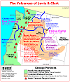
USGS/CVO Logo, click to link to National USGS Website
USGS/Cascades Volcano Observatory, Vancouver, Washington

The Volcanoes of Lewis and Clark

March 29, 1806

Heading Home -
Deer Island to Ridgefield NWR

 
Home
-- The Volcanoes of Lewis and Clark

Map of the Journey
-- Volcanoes, Basalt Plateaus, Major Rivers, etc.

CALENDAR of the Journey
-- October 1805 to June 1806

Along the Journey
-- Pacific Northwest Maps - Columbia River, Volcanoes, Flood Basalts, Missoula Floods, Geology, etc.

The Corps of Discovery
-- The Journey of Lewis and Clark

About the Reference Materials
-- The Journals, Biddle/Allen, DeVoto, Gass, Moulton, Topo Maps, and others

USGS Lewis and Clark Links
-- Links to USGS Websites highlighting the Lewis and Clark Journey

Resources
Publications Referenced and Websites Visited

PREVIOUS

March 25-28
Heading Home, Puget Island to Deer Island
March 29

Heading Home,
Deer Island to Ridgefield NWR

Deer Island, Puget Trough and Willamette Valley, Willamette River, Portland-Vancouver Plains, St. Helens (Oregon) and Mount St. Helens, Mount Hood, and Mount Adams, Multnomah Channel, Sauvie Island, Lewis River, Bachelor Island, Ridgefield NWR, Mount St. Helens and Mount Jefferson
CONTINUE

March 30
Vancouver, Washington, Sauvie Island to Vancouver, Washington
 

On October 7, 1805, Lewis and Clark and the "Corps of Discovery" began their journey down the Clearwater River and into the volcanics of the Pacific Northwest. The Corps travelled from the Clearwater to the Snake and down the "Great Columbia", finally reaching the Pacific Ocean on November 15, 1805. Along the journey they encountered the lava flows of the Columbia Plateau, river channels carved by the great "Missoula Floods", and the awesome beauty of five Cascade Range volcanoes.


Map, Lewis and Clark in the Pacific Northwest
(Click map for brief summary about the area)


The Volcanoes of Lewis and Clark
Heading for Home - March 1806
Heading Home
Deer Island to Ridgefield NWR

Saturday, March 29, 1806

The camp of March 28, 1806, was on the eastern shore of Deer Island, towards the northern tip.


Along the Journey - March 29, 1806
Map, 1887, Kalama vicinity, click to enlarge Map, 1887, Lewis River vicinity, click to enlarge NASA Image, 1994, Columbia River, Crim's Island to Deer Island, click to enlarge NASA Image, 1994, Columbia River, Deer Island to the Willamette River, click to enlarge NASA Image, 1994, Columbia River and Deer Island, click to enlarge Deer Island:
  1. 1887 Map (section of original), Columbia River and the Kalama vicinity, including Deer Island. (Click to enlarge). Original Map: The Columbia River from Celilo to the mouth showing locations of the salmon fisheries, 1887. Scale ca. 1:375,000, Relief shown by hachures. U.S. Army Corps of Engineers, Engineer Office, G.P.O. 1888. University of Washington Archives #UW128. -- University of Washington Library Archives Website, 2002
  2. 1887 Map (section of original), Columbia River and the Lewis River vicinity, including Deer Island. (Click to enlarge). Original Map: The Columbia River from Celilo to the mouth showing locations of the salmon fisheries, 1887. Scale ca. 1:375,000, Relief shown by hachures. U.S. Army Corps of Engineers, Engineer Office, G.P.O. 1888. University of Washington Archives #UW128. -- University of Washington Library Archives Website, 2002
  3. 1994, NASA Image, Columbia River from Crim's Island to Deer Island (section of original). (Click to enlarge). View from space - north-northeast-looking, low-oblique photograph, showing a section of the Columbia River from Crim's Island to Deer Island, including the Cowlitz River, October 1994. The Columbia River is flowing right to left in this image (east to west). Washington State is the upper half of the image (north) and Oregon is to the bottom half (south). NASA Earth from Space #STS068-262-025. -- NASA Earth from Space Website, 2002
  4. 1994, NASA Image, Columbia River from Deer Island to the Willamette River (section of original). (Click to enlarge). View from space - north-northeast-looking, low-oblique photograph, showing a section of the Columbia River from Deer Island to the Willamette River, including the Lewis River, Sauvie Island, Bachelor Island, and the Ridgefield National Wildlife Refuge, October 1994. The Columbia River is flowing from lower right to upper left in this image (southeast to northwest). Washington State is the upper right of the image and Oregon is to the bottom left. NASA Earth from Space #STS068-262-025. -- NASA Earth from Space Website, 2002
  5. 1994, NASA Image, Closer-in view, Columbia River and Deer Island (section of original). (Click to enlarge). View from space - north-northeast-looking, low-oblique photograph, showing a section of the Columbia River and Deer Island, Oregon, October 1994. NASA Earth from Space #STS068-262-025. -- NASA Earth from Space Website, 2002

Deer Island:
Deer Island was named by Lewis and Clark. They first visited the island on November 5, 1805, on their way down the Columbia, and again on March 28, 1806, on their return. It was on the second visit that the party had good luck getting venison. Captain Lewis noted in his diary that the Indian name for the island was 'E-lal-lar', or Deer Island. -- McArthur, 1982, Oregon Geographic Names


At an early hour we proceeded along the side of Deer island [Deer Island (Elallah Island)], and halted for breakfast at the upper end of it, which is properly the commencement of the great Columbian valley. [the Puget Trough and Willamette Valley]
"... we Set out very early this morning and proceeded to the head of deer island and took brackfast. the morning was very cold wind Sharp and keen off the rainge of Mountains to the East Covered with snow. ..." [Clark, March 29, 1806]


Along the Journey - March 29, 1806
Map, the Volcanoes of Lewis and Clark, click to enlarge NASA Image, 1994, Willamette Valley, click to enlarge Puget Trough and Willamette Valley:
  1. Map, The Volcanoes of Lewis and Clark, including Geologic Provinces and major Geographic Features (Click to enlarge). Map created by Lyn Topinka, USGS/CVO, 2002; Geologic Provinces based on "USGS/NPS Geology in the Parks" Website, 2002. -- USGS/CVO Web Graphics Collection, 2002
  2. 1994, NASA Image, Aerial view of Washington and Oregon, including the Willamette Valley. (Click to enlarge). NASA Astronaut Photography of Earth #STS068-276-55, October 3, 1994. -- NASA Astronaut Photography of Earth Website, 2002

Puget Trough and Willamette Valley:
The Puget-Willamette Lowlands extend from the United States-Canadian border south to Eugene, Oregon, between the Coast Ranges and the Cascade Mountains. The climate is subhumid to humid. The northern part is a flat glacial plain interrupted by the complex bays and inlets of Puget Sound. The southern part of the lowlands consists of alluvial valleys along the Cowlitz, Columbia, and Willamette Rivers. Most of Oregon's population, technology and agricultural centers, and important transportion, power, and communications lifelines are located in the Willamette Valley of western Oregon. The lowlands of the Willamette Valley extend about 75 miles along the Willamette River and contain the major cities of Portland, Salem, Corvallis, and Eugene. The valley is part of the Willamette River drainage basin, which covers 12,300 square miles between the crest of the Oregon Coast Range on the west and the Cascade Range to the east. -- Radbruch-Hall, et.al., 1982, USGS Professional Paper 1183, and Givler and Wells, 2001


Geology of the Willamette Valley:
The Willamette valley consists of four sub-basins: the southern and northern Willamette basins, the Tualatin basin, and the Portland basin. The Waldo Hills separate the southern Willamette basin from the northern basin, and the Chehalem Mountains separate the northern basin from the Tualatin Basin. Northeast of the Tualatin basin, the Tualatin Mountains form the divide with the Portland Basin. The Willamette Valley lies within a fore-arc basin between the Cascade Volcanic Arc and the Coast Ranges that may have originated in early Tertiary time. Some of the sub-basins have accumulated several hundred meters of sediment in late Cenozoic time. The northern basins also contain lavas of the Miocene Columbia River Basalt Group (CRBG). Flows of the CRBG entered the valley approximately 16 million years ago through a low in the Cascade Range and spread into the Portland and northern Willamette basins. The Tualatin Mountains, Chehalem Mountains, Waldo Hills, and Salem Hills are largely composed of CRBG flows that dip inward toward the basin centers. Approximately 3.0 million to 260,000 years ago, the Boring Lavas were erupted from several vents throughout the northern Willamette, Portland, and Tualatin basins. Boring Lavas capped the Oregon City plateau and created many of the prominent small cone-shaped hills and mountains southeast of downtown Portland. Between 15,000 and 12,700 years ago catastrophic floods from glacial Lake Missoula inundated the majority of the Willamette Valley. These floods reached up to 120 meters above sea level covering the valley with up to 35 meters of sediment and depositing ice-rafted boulders foreign to the Willamette Valley as far south as Eugene, Oregon. -- Gannett and Caldwell


We were here joined by three men of the Towahnahiook nation, with whom we proceeded

Lewis and Clark have reached the location of today's St. Helens, Oregon, on the right bank (their left) of the Columbia River.


Along the Journey - March 29, 1806
St. Helens, Oregon:
St. Helens, a deep-water seaport is located on the Columbia River 29 miles northwest of Portland, and 66 miles southwest of Astoria. It is a successful combination of recreation and industry, urban and rural, old and new. Situated on the beautiful Columbia River, a view to the east and north shows the majestic peaks of Mount Hood, Mount Adams and Mount St. Helens. Meriwether Lewis and William Clark passed the rocky bluffs on which St. Helens was later to be built, in the winter of 1805 on their memorable journey to the Pacific Ocean. Many of the old sailing ships stopped in the area to trade with the Indians. Nathaniel Wyeth of Boston established a temporary fort in 1832 at the lower end of Sauvie Island just across from St. Helens. The place of his first fort is still known as Warrior Rock. Bartholomew White had the first sawmill in St. Helens as early as 1844. This was taken over by Henry Knighton, en emigrant, in 1845. Knighton filed a pre-emption claim on land for the site of St. Helens in 1846 and moved here in 1847. Knighton had his claim surveyed and mapped in 1848-1850. He believed that his town, which he had first named Plymouth (after the New England town) and later Casenau (after a prominent Indian Chief) and eventually changed to St. Helens, would easily surpass the newly founded village of Portland as a fresh water port. Perhaps it might have, but the Pacific Mail docks in St. Helens burned, and Portland businessmen persuaded Pacific Mail to move its terminal to the new town on the Columbia River at the mouth of the Willamette River. Authorities differ on the source of the name of St. Helens. Some believe that Knighton named the settlement for the mountain plainly visible across the river, others insist that the Knighton family came from St. Helens, England, and named it for the old home town. The famous geologist, Thomas Condon, taught the first school in St. Helens. In 1854, Columbia County was created, being formerly a part of Washington County. After a heated battle, St. Helens was named the county seat in August 1903. The old courthouse made of locally quarried stone, was built in 1906. The resent town site was chartered by an act of the Legislature on February 25, 1889. The post office was established in 1853. -- St. Helens Chamber of Commerce Website, 2003


If the day had been clear the explorers would have seen Mount St. Helens to the northeast, and Mount Adams and Mount Hood to the east.,


Along the Journey - March 29, 1806
Map, 1855, Columbia River, Vancouver to the Pacific, click to enlarge Map, 1919 USGS topo map of Mount St. Helens, click to enlarge NASA Image, 1994, Aerial view, Columbia River Gorge, Mount Hood, Mount Adams, and Mount St. Helens, click to enlarge Engraving detail, 1879, Portland Oregon, Mount Rainier, and Mount St. Helens, click to enlarge Engraving detail, 1890, Portland Oregon, Mount Rainier, and Mount St. Helens, click to enlarge Image, 1973, Mount St. Helens and the Willamette River, click to enlarge Image, 1978, Mount St. Helens, before the May 18, 1980 eruption, click to enlarge Image, 1882, Mount St. Helens and Spirit Lake, after the 1980 eruption, click to enlarge Mount St. Helens:
  1. 1855 Map, Columbia River from Vancouver to the Pacific, including Mount Hood (although not named) (section of original). (Click to enlarge). Original Map: "Map of Oregon and Washington Territories: showing the proposed Northern Railroad route to the Pacific Ocean, by John Disturnell, 1855. University of Washington Archives #UW155. -- University of Washington Library Collections Website, 2002
  2. 1919 Map of Mount St. Helens (section of original), from Mount St. Helens 1:125,000 topographic quadrangle. (Click to enlarge). Original map surveyed in 1913-1914 and 1916, contour interval of 100 feet. Map published in 1919. -- University of Washington Library Collections Website, 2002
  3. 1994, NASA Image, Columbia River Gorge (section of original). (Click to enlarge). View from space - Columbia River and the Columbia River Gorge, west-northwest-looking, low-oblique photograph, September 1994. The Columbia River is running from the bottom (east) to the top (west). The Cascade Range is the dark color through the middle of the image, with Mount Hood on the Oregon side of the Columbia and Mount Adams and Mount St. Helens on the Washington side of the Columbia. NASA Earth from Space #STS064-112-092. -- NASA Earth from Space Website, 2002
  4. 1879, Detail from engraving of Portland, Oregon with Mount Rainier and Mount St. Helens. (Click to enlarge). Created by E.S. Glover. Published 1879, San Francisco. "Bird's-eye-view, looking east to the Cascade Mountains. Original lithograph shows Mount Rainier, Mount St. Helens, Mount Adams, and Mount Hood, and also the Columbia River and the Willamette River. Reference #LC Panoramic Maps #722. -- Library of Congress American Memories Website, 2002
  5. 1890, Detail from engraving of Portland, Oregon with Mount Rainier (???) and Mount St. Helens. (Click to enlarge). Created by Clohessy & Strengele. Published 1890, San Francisco. "Bird's-eye-view", Portland, Oregon, 1890. Original lithograph shows Mount Rainier (???), Mount St. Helens, Mount Adams, and Mount Hood, and also the Columbia River and the Willamette River. Reference #75694939. -- Library of Congress American Memories Website, 2002
  6. 1973, Photograph looking northerly across the Willamette River from a point near Lake Oswego in Clackamas and Multnomah Counties. The mountain dominating the far horizon is Mount St. Helens. (Click to enlarge). Oregon State Archives Photograph #OHD7567, Photograph Date: May 1973, From: Oregon Highway Division. -- Oregon State Archives Website, 2002
  7. 1978, View of Mount St. Helens, before the eruption of May 18, 1980. (Click to enlarge). U.S. Army Corps of Engineers Photograph #Sce0234. Photograph Date: 1978. Photographer: unknown. From: U.S. Army Corps of Engineers Photo Archives. -- U.S. Army Corps of Engineers Website, 2002
  8. 1982, USGS Photo showing Mount St. Helens after the May 18, 1980 eruption. The volcano is reflected in Spirit Lake. (Click to enlarge). USGS/CVO Photograph. Photograph Date: May 19, 1982. Photographer: Lyn Topinka. -- USGS/CVO Photo Archives, 2002
Mount St. Helens was known as "the Fuji of America" because its symmetrical beauty was similar to that of the famous Japanese volcano. The graceful cone top, whose glistening cap of perennial snow and ice dazzled the viewer, is now largely gone. On May 18, 1980, the missing mountaintop was transformed in a few hours into the extensive volcanic ash that blanketed much of the Northwestern United States and into various other deposits closer to the mountain. Even before its recent loss of height, Mount St. Helens was not one of the highest peaks in the Cascade Range. Its summit altitude of 9,677 feet (now the volcano is 8,364 feet), made it only the fifth highest peak in Washington. It stood out handsomely, however, from surrounding hills because it rose thousands of feet above them and had a perennial cover of ice and snow. The peak rose more than 5,000 feet above its base, where the lower flanks merge with adjacent ridges. The mountain is about 6 miles across at its base, which is at an altitude of about 4,400 feet on the northeastern side and about 4,000 feet elsewhere. At the pre-eruption timberline (upper limit of trees), the width of the cone was about 4 miles. Mount St. Helens is 34 miles almost due west of Mount Adams, which is in the eastern part of the Cascade Range. These "sister and brother" volcanic mountains are each about 50 miles from Mount Rainier, the giant of Cascade volcanoes. Mount Hood, the nearest major volcanic peak in Oregon, is about 60 miles southeast of Mount St. Helens. Mount St. Helens was named for British diplomat Alleyne Fitzherbert (1753-1839), whose title was Baron St. Helens. The mountain was named by Commander George Vancouver and the officers of H.M.S.Discovery while they were surveying the northern Pacific coast from 1792 to 1794. -- Foxworthy and Hill, 1982


Map, 1855, Columbia River, Vancouver to the Pacific, click to enlarge Map, 1904 USGS topo map of Mount Adams, click to enlarge NASA Image, 1994, Columbia River Gorge, Mount Hood, Mount Adams, and Mount St. Helens, click to enlarge NASA Image, 1997, Columbia River, Mount Hood, and Mount Adams, click to enlarge Image, 1987, Mount Adams, click to enlarge Engraving detail, 1879, Portland Oregon and Mount Adams, click to enlarge Engraving detail, 1890, Portland Oregon and Mount Adams, click to enlarge Image, ca.1913, Mount Adams, click to enlarge Mount Adams:
  1. 1855 Map, Columbia River from Vancouver to the Pacific, including Mount Hood (although not named) (section of original). (Click to enlarge). Original Map: "Map of Oregon and Washington Territories: showing the proposed Northern Railroad route to the Pacific Ocean, by John Disturnell, 1855. University of Washington Archives #UW155. -- University of Washington Library Collections Website, 2002
  2. 1904, Map of Mount Adams (section of original), from Mount Adams 1:125,000 topographic quadrangle. (Click to enlarge). Original map surveyed in 1903-1904, contour interval of 100 feet. Map published in 1964. -- University of Washington Library Collections Website, 2002
  3. 1994, NASA Image, Columbia River Gorge (section of original). (Click to enlarge). View from space - Columbia River and the Columbia River Gorge, west-northwest-looking, low-oblique photograph, September 1994. The Columbia River is running from the bottom (east) to the top (west). The Cascade Range is the dark color through the middle of the image, with Mount Hood on the Oregon side of the Columbia and Mount Adams and Mount St. Helens on the Washington side of the Columbia. NASA Earth from Space #STS064-112-092. -- NASA Earth from Space Website, 2002
  4. 1997, NASA Image, Columbia River looking northeast, with Mount Adams and Mount Hood (Click to enlarge). View from space - Columbia River, Willamette Valley, Columbia Plateau, Mount Adams, and Mount Hood. In this northeast-looking photograph the Columbia River flows right (east) to left (west). NASA Earth from Space #STS085-734-085. -- NASA Earth from Space Website, 2002
  5. 1987, USGS Photo shows Mount Adams as seen from Trout Lake, Washington. (Click to enlarge). USGS Photo by Lyn Topinka. -- USGS Cascades Volcano Observatory Photo Archives, 2002
  6. 1879, Detail from engraving of Portland, Oregon with Mount Adams. (Click to enlarge). Created by E.S. Glover. Published 1879, San Francisco. "Bird's-eye-veiw, looking east to the Cascade Mountains. Original lithograph shows Mount Rainier, Mount St. Helens, Mount Adams, and Mount Hood, and also the Columbia River and the Willamette River. Reference #LC Panoramic Maps #722. -- Library of Congress American Memories Website, 2002
  7. 1890, Detail from engraving of Portland, Oregon with Mount Adams. (Click to enlarge). Created by Clohessy & Strengele. Published 1890, San Francisco. "Bird's-eye-view", Portland, Oregon, 1890. Original lithograph shows Mount Rainier (???), Mount St. Helens, Mount Adams, and Mount Hood, and also the Columbia River and the Willamette River. Reference #75694939. -- Library of Congress American Memories Website, 2002
  8. ca.1913, Mount Adams. (Click to enlarge). Photograph Date: approximately 1913. -- University of Washington Libraries Website, 2002
Mount Adams stands astride the Cascade Crest some 30 miles due east of Mount St. Helens. The towering stratovolcano is marked by a dozen glaciers, most of which are fed radially from its summit icecap. Mount Adams (12,276 feet), is one of the largest volcanoes in the Cascade Range, and dominates the Mount Adams volcanic field in Skamania, Yakima, Klickitat, and Lewis counties and the Yakima Indian Reservation of south-central Washington. The nearby Indian Heaven and Simcoe Mountains volcanic fields lie west and southeast, respectively, of the 500-square-miles Adams field. Even though Mount Adams has been less active during the past few thousand years than neighboring Mounts St. Helens, Rainier, and Hood, it assuredly will erupt again. Future eruptions will probably occur more frequently from vents on the summit and upper flanks of Mount Adams than from vents scattered in the volcanic fields beyond. Large landslides and lahars that need not be related to eruptions probably pose the most destructive, far-reaching hazard of Mount Adams. -- Hildreth, 1990, IN: Wood and Kienle, and Scott, et.al., 1995


Map, 1855, Columbia River, Vancouver to the Pacific, click to enlarge Map, 1911 USGS topo map of Mount Hood, click to enlarge NASA Image, 1994, Columbia River Gorge, Mount Hood, Mount Adams, and Mount St. Helens, click to enlarge NASA Image, 1997, Columbia River, Mount Hood, and Mount Adams, click to enlarge Engraving, 1848, Mount Hood and Oregon City, Oregon, click to enlarge Engraving, 1853, The Dalles, Oregon, with Mount Hood, click to enlarge Engraving detail, 1884, The Dalles and Mount Hood, with Mill Creek, click to enlarge Engraving detail, 1879, Portland Oregon and Mount Hood, click to enlarge Engraving detail, 1890, Portland Oregon and Mount Hood, click to enlarge Penny Postcard, ca.1915, Mount Hood from The Dalles, click to enlarge Penny Postcard, ca1930, Mount Hood as seen from White Salmon, Washington, click to enlarge Penny Postcard, ca.1930, Portland, Oregon and Mount Hood, click to enlarge Image, Mount Hood from Timberline, click to enlarge Mount Hood:
  1. 1855 Map, Columbia River from Vancouver to the Pacific, including Mount Hood (although not named) (section of original). (Click to enlarge). Original Map: "Map of Oregon and Washington Territories: showing the proposed Northern Railroad route to the Pacific Ocean, by John Disturnell, 1855. University of Washington Archives #UW155. -- University of Washington Library Collections Website, 2002
  2. 1911 Map of Mount Hood (section of original), from Mount Hood and Vicinity 1:125,000 topographic quadrangle. (Click to enlarge). Original map surveyed in 1907 and 1909-1911, contour interval of 100 feet. -- University of Washington Library Collections Website, 2002
  3. 1994, NASA Image, Columbia River Gorge (section of original). (Click to enlarge). View from space - Columbia River and the Columbia River Gorge, west-northwest-looking, low-oblique photograph, September 1994. The Columbia River is running from the bottom (east) to the top (west). The Cascade Range is the dark color through the middle of the image, with Mount Hood on the Oregon side of the Columbia and Mount Adams and Mount St. Helens on the Washington side of the Columbia. NASA Earth from Space #STS064-112-092. -- NASA Earth from Space Website, 2002
  4. 1997, NASA Image, Columbia River looking northeast, with Mount Adams and Mount Hood (Click to enlarge). View from space - Columbia River, Willamette Valley, Columbia Plateau, Mount Adams, and Mount Hood. In this northeast-looking photograph the Columbia River flows right (east) to left (west). NASA Earth from Space #STS085-734-085. -- NASA Earth from Space Website, 2002
  5. 1848, Etching of Mount Hood and American Village (Oregon City). (Click to enlarge). Etching by Henry James Warre, 1848. Oregon City was first settled in 1829. Dr. John McLoughlin is generally credited as the town's founding father, having contructed an early lumber mill there. Oregon City was an early capitol of the territory, until the territorial capitol was finally moved to Salem in 1851. In his book, the artist (Henry Warre) notes that a rival city had sprung up further down the Willamette during the summer of 1845 - this would become Portland, Oregon. Washington State University Archives Collection #WSU554. -- Washington State University Libray Archives Website, 2002
  6. 1853 Engraving, Columbia River area indian camp at The Dalles, Oregon, with Mount Hood in the background. (Click to enlarge). Engraving by John M. Stanley, 1853. From the U.S. War Department's Reports of explorations and surveys to ascertain the most practicable and econmical route for a railroad from the Mississippi River to the Pacific Ocean, 1860, v.12, pt.1, pl.43. University of Washington Libraries Collection, #NA4170. -- University of Washington Libraries Website, 2002
  7. 1884, Closer-in detail from engraving of The Dalles, Oregon, and Mount Hood. (Click to enlarge). Created by H. Wellge. Published 1884, J.J. Stoner, Madison, Wisconsin. Panoramic view of the city of The Dalles, Oregon, county seat of Wasco County, 1884. Original lithograph shows The Dalles, Mount Hood, the Columbia River, and the mouth of Mill Creek. Reference #LC Panoramic Maps #727. -- Library of Congress American Memories Website, 2002
  8. 1879, Detail of engraving of Portland, Oregon and Mount Hood. (Click to enlarge). Created by E.S. Glover. Published 1879, San Francisco. "Bird's-eye-veiw, looking east to the Cascade Mountains. Original lithograph shows Mount Rainier, Mount St. Helens, Mount Adams, and Mount Hood, and also the Columbia River and the Willamette River. Reference #LC Panoramic Maps #722. -- Library of Congress American Memories Website, 2002
  9. 1890, Detail from engraving of Portland, Oregon with Mount Hood. (Click to enlarge). Created by Clohessy & Strengele. Published 1890, San Francisco. "Bird's-eye-view", Portland, Oregon, 1890. Original lithograph shows Mount Rainier (???), Mount St. Helens, Mount Adams, and Mount Hood, and also the Columbia River and the Willamette River. Reference #75694939. -- Library of Congress American Memories Website, 2002
  10. ca.1915, Penny Postcard, Mount Hood from near The Dalles. (Click to enlarge). "Mount Hood as seend from bank of the Columbia River near The Dalles, Ore.", A.M. Prentiss Photo. #447, Lipschuetz of Katz, Portland, Oregon. -- L.Topinka private collection, 2003, used with permission.
  11. ca.1930, Penny Postcard, Mount Hood as seen from White Salmon, Washington. (Click to enlarge). "Mount Hood and Interstate Bridge to Columbia River Highway from Evergreen Highway, White Salmon, Wash. to Hood River, Oregon." #826. -- L.Topinka private collection, 2003, used with permission
  12. ca.1930, Penny Postcard. Portland, Oregon and Mount Hood. (Click to enlarge). Angelus Commercial studio, Portland, Oregon. -- L.Topinka private collection, 2003, used with permission.
  13. Mount Hood, as seen from Timberline. (Click to enlarge). USGS photo by Lyn Topinka. -- USGS Cascades Volcano Observatory Photo Archives, 2002
Snow-clad Mount Hood dominates the Cascade skyline from the Portland metropolitan area to the wheat fields of Wasco and Sherman Counties. The mountain contributes valuable water, scenic, and recreational resources that help sustain the agricultural and tourist segments of the economies of surrounding cities and counties. Mount Hood is also one of the major volcanoes of the Cascade Range, having erupted repeatedly for hundreds of thousands of years, most recently during two episodes in the past 1,500 years. The last episode ended shortly before the arrival of Lewis and Clark in 1805, and consisted of growth and collapse of a lava dome that sent numerous pyroclastic flows down the south and west flanks. Crater Rock is the remnant of that dome. Mount Hood is 11,245 feet high, is the fourth highest peak in the Cascades, and the highest in Oregon. It was named after a British admiral and first described in 1792 by William Broughton, a member of an expedition under command of Captain George Vancouver. -- Scott, et.al., 1997, Gardner, et.al., 2000, and Swanson, et.al., 1989


till at the distance of fourteen miles from our camp of last evening we reached a large inlet or arm of the river, about three hundred yards wide, up which they went to their villages. [Multnomah Channel, heading down the east side of Sauvie Island]


Along the Journey - March 29, 1806
Map, 1887, Sauvie Island vicinity, click to enlarge NASA Image, 1994, Aerial view, Columbia River, Deer Island to the Willamette River, click to enlarge NASA Image, 1994, Aerial view Columbia River upstream of Vancouver, showing Sauvie Island, click to enlarge Multnomah Channel:
  1. 1887 Map (section of original), Columbia River and the Sauvie Island vicinity. (Click to enlarge). Bachelor Island, while not named on the map, is the island south (below) the Lewis River (upper right). The Willamette Slough is today called the Multnomah Channel. Original Map: The Columbia River from Celilo to the mouth showing locations of the salmon fisheries, 1887. Scale ca. 1:375,000, Relief shown by hachures. U.S. Army Corps of Engineers, Engineer Office, G.P.O. 1888. University of Washington Archives #UW128. -- University of Washington Library Archives Website, 2002
  2. 1994, NASA Image, Columbia River from Deer Island to the Willamette River (section of original). (Click to enlarge). View from space - north-northeast-looking, low-oblique photograph, showing a section of the Columbia River from Deer Island to the Willamette River, including the Lewis River, Sauvie Island, Bachelor Island, and the Ridgefield National Wildlife Refuge, October 1994. The Columbia River is flowing from lower right to upper left in this image (southeast to northwest). Washington State is the upper right of the image and Oregon is to the bottom left. NASA Earth from Space #STS068-262-025. -- NASA Earth from Space Website, 2002
  3. 1994, NASA Image, Closer-in view, Columbia River and Sauvie Island (section of original). (Click to enlarge). View from space - north-northeast-looking, low-oblique photograph, showing a section of the Columbia River and Sauvie Island, Oregon, October 1994. NASA Earth from Space #STS068-262-025. -- NASA Earth from Space Website, 2002


"... after breakfast we proceeded on and at the distance of 14 miles from our encampment of the last evening we passed a large inlet 300 yds in width. [Multnomah Channel] this inlet or arm of the river extends itself to the South 10 or 12 M. to the hills on that side of the river and receives the waters of a small creek which heads with killamucks river [Moulton says this is possibly the McCarthy Creek, however, McCarthy Creek does not meet with the Tillamook River on the coast.], and that of a bayau which passes out of the Columbia about 20 miles above, the large Island thus formed we call wappetoe island [Sauvie Island] . ..." [Lewis, March 29, 1806]


Along the Journey - March 29, 1806
Map, 1887, Sauvie Island vicinity, click to enlarge NASA Image, 1994, Columbia River, Deer Island to the Willamette River, click to enlarge NASA Image, 1994, Columbia River upstream of Vancouver, showing Sauvie Island, click to enlarge NASA Image, 1992, Columbia River with Portland, Oregon, and Vancouver, Washington, click to enlarge NASA Image, 1992, Columbia River upstream of Vancouver, showing Sauvie Island, click to enlarge Sauvie Island:
  1. 1887 Map (section of original), Columbia River and the Sauvie Island vicinity. (Click to enlarge). Bachelor Island, while not named on the map, is the island south (below) the Lewis River. Original Map: The Columbia River from Celilo to the mouth showing locations of the salmon fisheries, 1887. Scale ca. 1:375,000, Relief shown by hachures. U.S. Army Corps of Engineers, Engineer Office, G.P.O. 1888. University of Washington Archives #UW128. -- University of Washington Library Archives Website, 2002
  2. 1994, NASA Image, Columbia River from Deer Island to the Willamette River (section of original). (Click to enlarge). View from space - north-northeast-looking, low-oblique photograph, showing a section of the Columbia River from Deer Island to the Willamette River, including the Lewis River, Sauvie Island, Bachelor Island, and the Ridgefield National Wildlife Refuge, October 1994. The Columbia River is flowing from lower right to upper left in this image (southeast to northwest). Washington State is the upper right of the image and Oregon is to the bottom left. NASA Earth from Space #STS068-262-025. -- NASA Earth from Space Website, 2002
  3. 1994, NASA Image, Closer-in view, Columbia River and Sauvie Island (section of original). (Click to enlarge). View from space - north-northeast-looking, low-oblique photograph, showing a section of the Columbia River and Sauvie Island, Oregon, October 1994. NASA Earth from Space #STS068-262-025. -- NASA Earth from Space Website, 2002
  4. 1992, NASA Image, Columbia River, Portland, Oregon, and Vancouver, Washington (section of original). (Click to enlarge). View from space - west-looking, low-oblique photograph, showing a section of the Columbia River with Government Island, the Sandy River, Portland, Oregon, and Vancouver, Washington, September 1992. The Columbia River is flowing from bottom (east) to top (west). NASA Earth from Space #STS047-096-066. -- NASA Earth from Space Website, 2002
  5. 1992, NASA Image, Columbia River upstream of Vancouver, Washington, showing Bachelor Island and the Ridgefield National Wildlife Refuge (section of original). (Click to enlarge). View from space - west-looking, low-oblique photograph, showing a section of the Columbia River upstream of Vancouver, Washington, September 1992. Bachelor Island is on the right side of the image, just barely discernible as an island (light colored yellowish area). Bachelor Island Slough separates Bachelor Island from the mainland. The area next to the Columbia on the right and the left side of Bachelor Island is part of the Ridgefield National Wildlife Refuge. The upper half of the image is Sauvie Island, with the Willamette River on it's left, the Columbia River on the bottom, and the Multnomah Channel on the upper side. NASA Earth from Space #STS047-096-066. -- NASA Earth from Space Website, 2002

Sauvie Island:
Sauvie Island contains approximately 24,000 acres of land and lakes, and had its origin in alluvial deposits from the Columbia and Willamette rivers as their velocities decreased by changes in direction and by lava extrusions located on the north end. The island is 16 miles long and 4.5 miles at the widest point. The Sauvie Island wildlife area includes 8,053 acres of deeded land and 3,490 acres of land leased from the Division of State Lands for wildlife management purposes. The island is bounded on the east by the Columbia River; on the south by the Willamette River and on the west by the Multnomah Channel. Across the river on the Washington side, Scappoose Bay provides fish and wildlife habitat. Sauvie Island is the largest island in the Columbia River, and is for the most part low land and lakes. The highest point on the island is only about 50 feet above sea level. Lewis and Clark called it 'Wap-pa-to' and 'Wap-pa-too', the Indian name for the arrowhead or sagittaria. This was the wild potato, a valuable article of Indian food. Broughton visited the island in 1792 and named the western end of the island "Warrior Point" and the upstream point "Belle Vue Point." Lewis and Clark first visited the island on November 4, 1805. N.J. Wyeth built Fort William on this island in 1834-35 and some early maps have the name Wyeth Island. Wilkes used the name Multnomah Island. The name Sauvie Island comes from a French-Canadian employee of the Hudson's Bay Company who worked at the dairy farm on the west side of the island. The lettering Sauvies Island appears on Preston's 'Map of Oregon', 1856. The U.S. Board of Geographic Names adopted the style Sauvie Island ranther than the possessive Sauvies Island. -- McArthur, 1982, Oregon Geographic Names, Columbia Basin Fish and Wildlife Authority Website, 2002, Oregon State Archives Website, 2002, and Washington State Historical Society Website, 2002


Geology of Sauvie Island:
Both the northern quarter-mile of the tip of Sauvie Island and the usually submerged Warrior Rock are composed of the hard black Columbia River basalt that also underlies the city of St. Helens. These basalts are part of the series of lava flows that came down the ancestral Columbia River valley 12 million to 14 million years ago. Warrior Rock is a basalt reef that lies beneath the surface of the Columbia River during high water, near the east side of Sauvie Island, 3/4-mile south of its northern tip. Warrior Rock takes it name from Warrior Point, the prominent basalt pinnacle that stands 38 feet above sea level near the north end of Sauvie Island. -- Allen, 1985


A short distance above this inlet a considerable river empties itself from the north side of the Columbia. Its name is Chawahnahiooks [Lewis River]. It is about one hundred and fifty yards wide, and at present discharges a large body of water, though the Indians assure us that at a short distance above its mouth, the navigation is obstructed by falls and rapids.


Along the Journey - March 29, 1806
Map, 1887, Lewis River vicinity, click to enlarge NASA Image, 1994, Aerial view, Columbia River, Deer Island to the Willamette River, click to enlarge NASA Image, 1994, Aerial view, Columbia River at the mouth of the Lewis River, click to enlarge Image, Lewis River Bridge, click to enlarge Lewis River:
  1. 1887 Map (section of original), Columbia River and the Lewis River vicinity. (Click to enlarge). Bachelor Island, while not named on the map, is the island south (below) the Lewis River. Original Map: The Columbia River from Celilo to the mouth showing locations of the salmon fisheries, 1887. Scale ca. 1:375,000, Relief shown by hachures. U.S. Army Corps of Engineers, Engineer Office, G.P.O. 1888. University of Washington Archives #UW128. -- University of Washington Library Archives Website, 2002
  2. 1994, NASA Image, Columbia River from Deer Island to the Willamette River (section of original). (Click to enlarge). View from space - north-northeast-looking, low-oblique photograph, showing a section of the Columbia River from Deer Island to the Willamette River, including the Lewis River, Sauvie Island, Bachelor Island, and the Ridgefield National Wildlife Refuge, October 1994. The Columbia River is flowing from lower right to upper left in this image (southeast to northwest). Washington State is the upper right of the image and Oregon is to the bottom left. NASA Earth from Space #STS068-262-025. -- NASA Earth from Space Website, 2002
  3. 1994, NASA Image, Closer-in, Columbia River at the junction with the Lewis River (section of original). (Click to enlarge). View from space - north-northeast-looking, low-oblique photograph, showing a section of the Columbia River at the spot where the Lewis River enters, October 1994. In this photograph, the Columbia River is running from right to left, with Washington State to the east (upper 3/4 of image) and Oregon to the west (lower left quarter). Lake Merwin, created by Merwin Dam, is shown in the upper right corner. NASA Earth from Space #STS068-262-025. -- NASA Earth from Space Website, 2002
  4. Lewis River Bridge. (Click to enlarge). Bridge crossing the Lewis River, near Woodland, Washington. Image from the 1912-1914 Biennial Report. -- Washington State Department of Transportation Website, 2003

Lewis River:
Located along the Columbia River in Southwest Washington, the Lewis River contains portions of three counties (Clark, Cowlitz, and Skamania) The Lewis River flows into the Columbia River at RM 87. The Lewis River watershed includes two large drainages, the North Fork and East Fork, which converge approximately 3.5 miles upriver from the confluence with the Columbia River. The watershed is approximately 93 miles long, has a total fall of approximately 12,000 feet, and drains an area of about 1,050 square miles. The headwaters arise on the southern flanks of Mount St. Helens and Mount Adams. The mainstem of the Lewis, also known as the North Fork, flows southwesterly from its source in Skamania County through three impoundments, Swift Reservoir (River Mile 47.9), Yale Reservoir (34.2), and Merwin Lake (RM 19.5). The middle and lower sections of the North Fork Lewis form the boundary between Clark and Cowlitz Counties. A major tributary, the East Fork Lewis River, enters the mainstem at RM 3.5. From this point the mainstem Lewis flows westerly, entering the Columbia River at RM 88. The average annual streamflow for the entire Lewis River system is approximately 6,125 cubic feet per second (cfs). The lower 12 miles of the mainstem and North Fork Lewis River flows through a wide flat valley, much of which is under cultivation and protected from flooding by dikes. The lower 11 miles are a tidally influenced backwater of the Columbia River. Within this area, the flow is sluggish and the sediments are generally composed of sand, silts, and clays typical of lower floodplains. -- Columbia Basin Fish and Wildlife Authority Website, 2003


Geology of the Lewis River Basin:
The basin has a complex geologic history, having undergone Tertiary volcanism, several glaciations, and interglacial erosion and deposition. Bedrock surrounding the reservoirs is predominately comprised of younger Eocene to older Oligocene volcanic lava flows Oligocene volcaniclastic rocks, and Quaternary volcaniclastic deposits. The volcanic rocks have undergone regional compressional deformation; rock strata are folded by a major southeast plunging anticline and a southeast plunging syncline. -- Columbia Basin Fish and Wildlife Authority Website, 2003


Lewis River History:
The captains used "Chah-wah-na-hi-ook River" to identify a "Small river" that entered the Columbia on the north shore. Their name was a figurative form of the Chinookan term for "enemies." Later another river would be identified with the same aboriginal term; however, their spelling of the word for "enemies" was different. Translation was difficult for the captains on the lower Columbia River because nobody in the party spoke the difficult aboriginal languages. In 1853 a railroad surveyor charted the river as "Cathlapootle," a distortion of a common name for the river used by early explorers, fur traders, and settlers. Today the river is named for Adolphus Lee Lewis, a descendent of an Hudson's Bay Company employee who homesteaded near the river's mouth, not for Captain Meriwether Lewis of the Corps of Discovery. The Lewis River, with a drainage area of approximately 1,050 square miles, has its source on Mount Adams and enters the Columbia from the northeast about 19 miles below the mouth of the Willamette River. The headwaters of several tributaries to the Lewis River are on Mount St. Helens. Two tributaries, the Muddy River and Pine Creek, were inundated by mudflows during the May 18, 1980 eruption of Mount St. Helens. The Clearwater River basin, while not affected my mudflows, received heavy tephra deposits with the eruption blast. -- Washington State Historical Society Website, 2002, and Dinehart, 1992


Map, 1978, Mount St. Helens and Vicinity, click to enlarge River Drainages of Mount St. Helens:
  1. 1978 Map, Mount St. Helens and Vicinity, and its major river drainages. (Click to enlarge). Swift Creek, Pine Creek, and the Muddy River drain the southern flanks of Mount St. Helens and drain into the Lewis River. The Kalama River drains west into the Columbia River. The North and South Fork Toutle Rivers drain to the north west and enter the Cowlitz (a tributary from Mount Rainier), which drains into the Columbia River south of Longview, Washington. Map modified from Crandell and Mullineaux, 1978, USGS Bulletin 1383-C.

Map, 1999, Mount Adams and Vicinity, click to enlarge River Drainages of Mount Adams:
  1. 1999 Map, Mount Adams and Vicinity, with major river drainages. (Click to enlarge). The headwaters of the Lewis River are shown on the left of the map. Map also includes the Wind River, Little White Salmon River, White Salmon River, and Klickitat River which flow into the Columbia River. Map modified from Vallance, 1999, USGS Bulletin 2161.


Three miles beyond the inlet is an island near the north shore of the river [Bachelor Island], behind the lower end of which is a village of Quathlapotles, where we landed, about three o'clock. ......


Along the Journey - March 29, 1806
    Map, 1887, Lewis River vicinity, click to enlarge NASA Image, 1994, Columbia River, Deer Island to the Willamette River, click to enlarge NASA Image, 1992, Columbia River upstream of Vancouver, showing Bachelor Island, click to enlarge Bachelor Island:
    1. 1887 Map (section of original), Columbia River and the Lewis River vicinity, including Bachelor Island. (Click to enlarge). Bachelor Island, while not named on the map, is the island south (below) the Lewis River. Original Map: The Columbia River from Celilo to the mouth showing locations of the salmon fisheries, 1887. Scale ca. 1:375,000, Relief shown by hachures. U.S. Army Corps of Engineers, Engineer Office, G.P.O. 1888. University of Washington Archives #UW128. -- University of Washington Library Archives Website, 2002
    2. 1994, NASA Image, Columbia River from Deer Island to the Willamette River (section of original). (Click to enlarge). View from space - north-northeast-looking, low-oblique photograph, showing a section of the Columbia River from Deer Island to the Willamette River, including the Lewis River, Sauvie Island, Bachelor Island, and the Ridgefield National Wildlife Refuge, October 1994. The Columbia River is flowing from lower right to upper left in this image (southeast to northwest). Washington State is the upper right of the image and Oregon is to the bottom left. NASA Earth from Space #STS068-262-025. -- NASA Earth from Space Website, 2002
    3. 1992, NASA Image, Closer-in, Columbia River upstream of Vancouver, Washington, showing Bachelor Island and the Ridgefield National Wildlife Refuge (section of original). (Click to enlarge). View from space - west-looking, low-oblique photograph, showing a section of the Columbia River upstream of Vancouver, Washington, September 1992. Bachelor Island is on the right side of the image, just barely discernible as an island (light colored yellowish area). Bachelor Island Slough separates Bachelor Island from the mainland. The area next to the Columbia on the right and the left side of Bachelor Island is part of the Ridgefield National Wildlife Refuge. The upper half of the image is Sauvie Island, with the Willamette River on it's left, the Columbia River on the bottom, and the Multnomah Channel on the upper side. NASA Earth from Space #STS047-096-066. -- NASA Earth from Space Website, 2002

    Bachelor Island:
    Lewis and Clark first called the island "Green Bryor Isd," when they traveled downriver in 1805 but changed the name to "Quathlahpotle Island" in 1806. They honored the large village of 14 wooden houses and 900 inhabitants on the mainland, naming the island for the native village. In 1841 Wilkes charted the island as "Pasauks Island." The present name is of local origin, in honor of an unmarried man who took a donation claim on the island. Bachelor Island is now part of the Ridgefield National Wildlife Refuge. [See November 5, 1805 entry] -- Washington State Historical Society Website, 2002


After remaining some time we embarked, and coasting along this island, which after the nation we called Quathlapotle island [Bachelor Island], encamped for this night in a small prairie on the north side of the Columbia [in today's Ridgefield National Wildlife Refuge],


Along the Journey - March 29, 1806
Map, 1887, Lewis River vicinity, click to enlarge NASA Image, 1994, Aerial view, Columbia River, Deer Island to the Willamette River, click to enlarge Ridgefield National Wildlife Refuge:
  1. 1887 Map (section of original), Columbia River and the Lewis River vicinity. (Click to enlarge). Today's Ridgefield National Wildlife Refuge is located below the Lewis River. Original Map: The Columbia River from Celilo to the mouth showing locations of the salmon fisheries, 1887. Scale ca. 1:375,000, Relief shown by hachures. U.S. Army Corps of Engineers, Engineer Office, G.P.O. 1888. University of Washington Archives #UW128. -- University of Washington Library Archives Website, 2002
  2. 1994, NASA Image, Columbia River from Deer Island to the Willamette River (section of original). (Click to enlarge). View from space - north-northeast-looking, low-oblique photograph, showing a section of the Columbia River from Deer Island to the Willamette River, including the Lewis River, Sauvie Island, Bachelor Island, and the Ridgefield National Wildlife Refuge, October 1994. The Columbia River is flowing from lower right to upper left in this image (southeast to northwest). Washington State is the upper right of the image and Oregon is to the bottom left. NASA Earth from Space #STS068-262-025. -- NASA Earth from Space Website, 2002

Ridgefield National Wildlife Refuge:
The Ridgefield National Wildlife Refuge Complex is comprised of five refuges located in the southwest part of the state of Washington: Ridgefield north of Vancouver; Conboy in the southcentral part of the state; and Franz Lake, Pierce and Steigerwald Lake all located in the Columbia River Gorge. The refuge north of Vancouver, Washington, was established in 1965 in response to a need to establish vital winter habitat for the dusky Canada goose whose nesting areas in Alaska were severly impacted by the violent earthquake of 1964. This refuge is the location of two Lewis and Clark campsites (November 4, 1805 and March 29, 1806), and is an ancient Chinook townsite visited by the Expedition. In their journals, Lewis and Clark described the wapato plants that were harvested by the Chinook women, as well as, the geese and ducks that kept them awake at night. These species are still here today. Trails, auto tour, and wildlife viewing. Located 14 miles north of Vancouver, Washington. -- U.S. Fish and Wildlife Service Website, 2002, Lewis and Clark Bicentennial Website, 2002, and Lewis and Clark Bicentennial in Oregon Website, 2002


having made by estimate nineteen miles. ......


Along the Journey - March 29, 1806
The Camp - March 29, 1806:
In today's Ridgefield National Wildlife Refuge.


Return to:
[Volcanoes and History Menu] ...
[Living With Volcanoes Menu] ...


ButtonBar

URL for CVO HomePage is: <http://vulcan.wr.usgs.gov/home.html>
URL for this page is: <http://vulcan.wr.usgs.gov/LivingWith/Historical/LewisClark/volcanoes_lewis_clark_march_29_1806.html>
If you have questions or comments please contact: <GS-CVO-WEB@usgs.gov>
03/22/04, Lyn Topinka