Gage height, feet
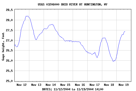
| Most recent value: 27.43 11-19-2004 14:00 | |
|
|
| Download a presentation-quality graph | Parameter Code 00065; DD 03 |
PROVISIONAL DATA SUBJECT TO REVISION |
||
LOCAL NAME: OHIO RIVER AT HUNTINGTON, WV LOCATION: Latitude 38 24 48", Longitude 82 30 02" NAD27, Lawrence County,Ohio Hydrologic Unit 05090101 DRAINAGE AREA: 55,580.00 square miles; Contributing drainage area 55,850 square ikes, GAGE: Datum of gage is 490.26 feet above sea level NGVD29. SITE TYPE: Stream / River OPERATION: Record for this site is maintained by the USGS office in West Virginia |
||
Gage height, feet |
|||||||
|
|||||||
| Questions about data | Water Webserver Team | Top |
| Feedback on this website | NWISWeb Support Team | Explanation of terms |